|
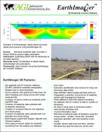
 Earth Imager 2D
2D resistivity imaging inversion and modeling software
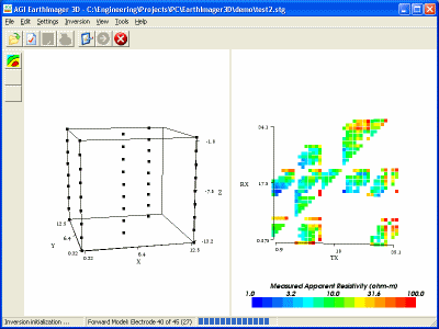
Earth
Imager 3D
3D resistivity imaging inversion software.
Cross Borehole Electrical
Resistivity Tomography (ERT) Measurements
Eletrodos (
Dual mode R8 )
 Literatura:
arquiologia
boiling spring
bridge_resistivity
bridge foundation
clear water
dam investigation ( investigação em
represa )
Water Intake
cave detection
geotechinical
survey - New Orleans
geotechinical survey - road
subsidence
geotechinical survey -
highway realignment
geotechinical survey -
roadway
geotechinical survey - road
subsidence 1
geotechinical survey - road
subsidence 2
geotechinical survey -
sink hole
geotechinical survey -
sink hole tx
geotechinical survey - TX1
geotechinical survey - TX2
resistivity survey - Hanford
resistivity survey - Karst
ground water
survey
lake resistivity survey
land under water
land fill survey
resistivity tomography
resistivity survey - cave
deep esistivity survey
tunnel investigation
marine survey
water fracture
|